
Sources for Boulder County Previous Residents
The backward trail needs sources that cover different eras. The recorder's office says its records date to 1860, but the online image and index cutoff was not stated. Carnegie holds directory, map, appraisal-card, newspaper, photograph, and building-history material. The Boulder Genealogical Society adds cemetery, obituary, census, and family-file indexes. A current assessor report helps identify today's parcel, not every person who occupied it before.
| Source | Years it covers | Where held | What it shows |
|---|---|---|---|
| Recorder index | Office records to 1860; online cutoff unstated | Clerk & Recorder Public Search | Grantor, grantee, document, date, legal description, deed chain |
| City and county directories | 1892 through present stated; identified index years 1892 to 1911 | Carnegie and digital local history | Name, printed address, town, and historical listing |
| Assessor appraisal cards | 1929 to 1965 | Carnegie collection 880 | Property and address-history clue; digitization in progress |
| Census indexes and maps | 1860, 1870, 1880, 1885, 1900, 1910; maps 1910 to 1940 | BGS and federal route | Household enumeration and geographic context |
| Newspapers and obituaries | 1869 to present microfilm; obituary ranges vary | Carnegie, BGS, Daily Camera routes | Events, relatives, service, cemetery, or address clues |
| Maps, Sanborns, and photos | Series-specific; photos 1870s to 1970s | Carnegie and municipal collections | Building, street, landmark, and neighborhood context |
The date range is a guide to where to look, not proof that every year survived or is online. A prior resident claim is strongest when a dated address source and a property or family source agree.
Boulder County Previous-Address Parcel
Start with a current parcel because the legal description gives the backward trail a stable reference. Use the county Property Search by address, account, parcel, owner, subdivision, section-township-range, or map click. Capture the situs address, mailing address, account, parcel, subdivision, neighborhood or market area, legal description, and current reports. The current owner field is a starting point, not a conclusion about prior residents.
Open county GIS or a city parcel map to compare the road, adjacent parcels, jurisdiction, zoning, flood, wildfire, and open-space layers. Then use the plat or legal description to make sure the deed chain follows the same land unit. A street number alone can be misleading after a subdivision, annexation, or renaming.
- Legal description
- The recorded land description used to tie an instrument to a parcel.
- Parcel
- A mapped land unit with an account or identifier.
- Chain of title
- A sequence of recorded ownership instruments, not a list of every occupant.
Boulder County Past-Resident Deed Chains
Search the Boulder County recorder by grantor and grantee, moving backward from the current instrument. Use the legal description, recorded date, document type, subdivision, document number, and OCR full-text option. A grantee may lead to an earlier grantor. An “et al.” party, trust name, or spelling variant can require a second pass.
Recorder categories include deeds, deeds of trust, liens, foreclosure documents, plats and maps, assignments, covenants, mining claims, and UCCs. A watermarked image can be viewed through the public route. Clean and certified copies have separate fee paths. The office's records-history note and recording fee schedule should be checked before ordering a copy. The image below shows the deed and grantor-grantee route that anchors a previous-residents search.
Use the Boulder County Public Search for the index and preserve the document or reception number.
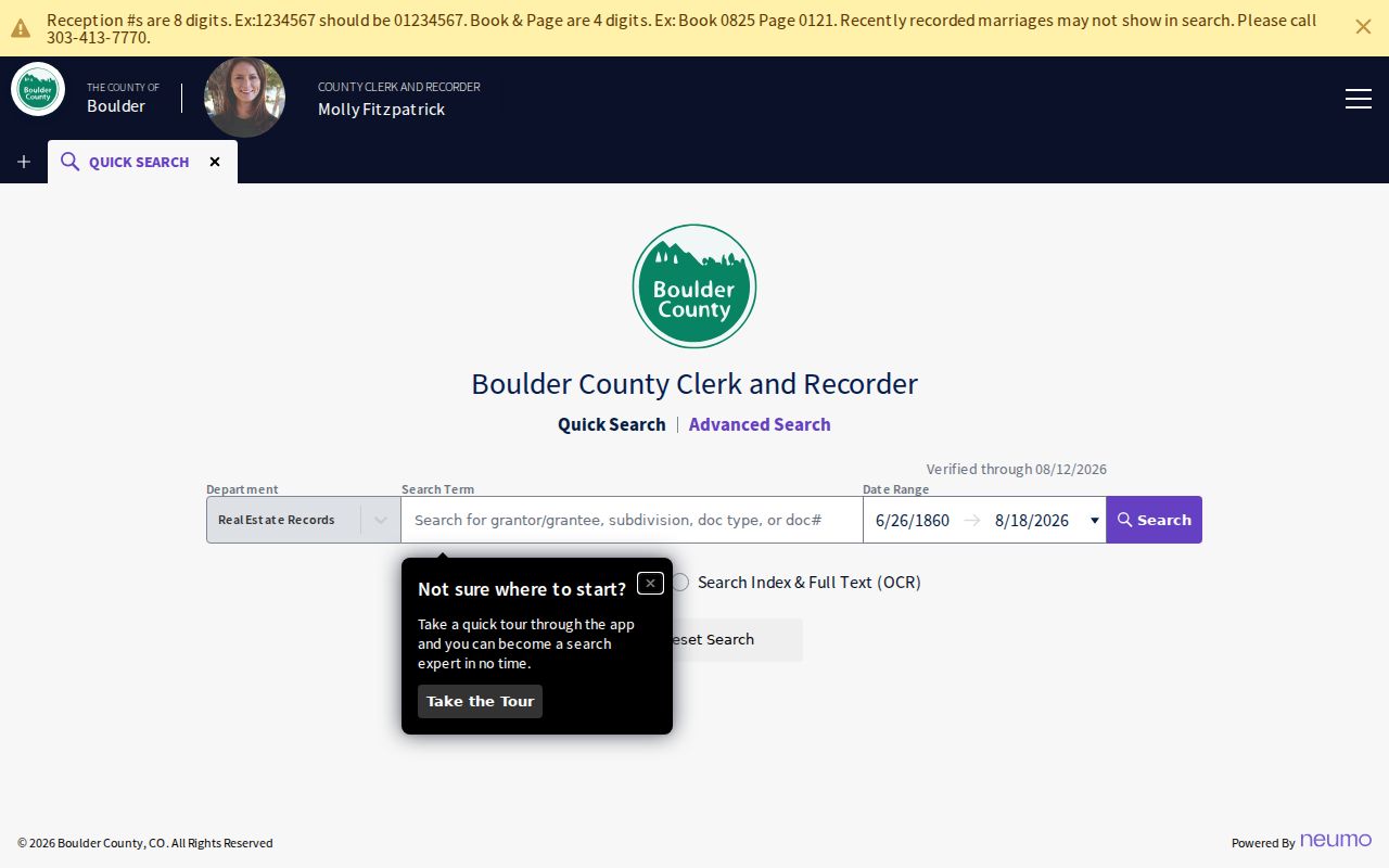
A deed chain establishes recorded instruments. It does not establish that every grantee lived at the property, so pair it with a directory, newspaper, appraisal card, or census entry.
Boulder County Assessor Cards
Carnegie collection 880 holds Boulder real-estate appraisal cards from 1929 through 1965 and is being digitized. A card can help connect a historic address to property description, owner, or building context between directory years. The collection is not described as a public name-only reverse index, and digitization does not mean every card is available immediately.
Use a card as a bridge. Compare its address with a deed legal description, a directory entry, a plat, a newspaper, or a modern parcel. Keep the card's collection number, date, printed address, and any uncertainty about handwriting or missing fields. Do not treat an appraisal card as a complete household roster.
The house-history route is documented at the Boulder Library building-research guide. Its capture places appraisal cards beside maps, Sanborns, photos, directories, and ownership records.
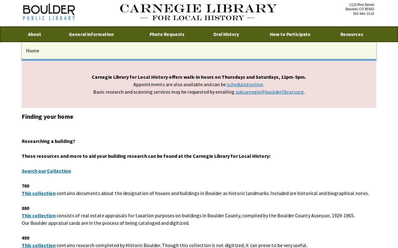
The guide is valuable because it points to a research sequence rather than promising one complete online property history.
Boulder County Directory Years
The city directory shelf supplies the household layer. Identified digital indexes cover Boulder and Longmont in 1892 to 1898, Boulder City in 1901 to 1903, a 1904 county run naming Boulder, Lafayette, Longmont, and Louisville, and Boulder City years in 1905 to 1908 and 1911. A broad Boulder City run is documented from 1892 to 1983, while the house-history guide says directories continue through the present. Exact year-by-year availability remains a Carnegie question.
Search the same person across consecutive volumes, but preserve each printed street form. A directory can list an address without proving ownership or current residence. It can also omit rural households, use an old town label, or reflect a publication gap. The full collection explanation lives on the Boulder County city directory page.
For prior residents, use the following process: address first, directory second, property record third, family or event source fourth. That order keeps a familiar name from pulling the research away from the actual house.
Boulder County Census Pairing
Census material fills gaps between directory volumes. The Boulder Genealogical Society inventory lists indexes for 1860, 1870, 1880, 1885, 1900, and 1910, plus enumeration maps from 1910 to 1940. The 1885 Colorado census is a useful local bridge between federal years. A census enumerates a household at a date; it does not become a deed or a current occupancy record.
- Choose a directory year and write the exact name, address, town, and printed form.
- Select the nearest census year and compare household members, age clues, and place labels.
- Use a map, plat, or appraisal card to test whether the address is the same land unit.
- Return to the recorder for an instrument, or to a newspaper, cemetery, or probate lead for the next date.
Federal census access follows its own release and archive rules. A local index can point to a page or map even when the index is not the complete federal record.
Boulder County Street Renaming
Boulder street history can break a simple address search. Numbered lots and houses supported free mail by 1889. Lots were numbered again in 1893, street signs appeared in 1896, and in 1902 Twelfth became Broadway while South Twentieth became Park Place. A previous resident may therefore appear under two street names across one household trail.
Keep the old form and modern form side by side only after checking a municipal map or transportation history. The house-history guide names Sanborn maps, plats, and maps, but the inspected research did not locate a complete sheet-year list or stable link set. Mark the Sanborn source as a lead rather than inventing coverage.
Address normalization is a research step. It is not permission to replace the printed evidence with a modern guess.
Boulder County Newspapers and Cemeteries
Newspapers and cemeteries can close a prior-resident trail. Carnegie lists Boulder and Boulder County microfilm from 1869 to the present, Daily Camera surname and subject archives, obituary index ranges from 1859 to 1925 and 1960 to the present, and mortuary or burial records. BGS lists cemetery interments, obituary indexes, and full obituaries at Carnegie for 1975 to 2017 according to its inventory.
Columbia Cemetery's early records are incomplete. Erie Mount Pleasant Cemetery history says records before 1901 are nearly absent and 1960s interment records are incomplete. A burial proves burial context, not necessarily death in Boulder County or residence at the address. An obituary can name relatives, service details, or a last community, but it is not a certified vital record.
Save the newspaper title, issue date, page, cemetery, index label, and source date. Then compare the event with the deed chain or directory year. Conflicting dates should remain visible until a stronger custodian record resolves them.
Boulder County PropertyAlert
PropertyAlert does not reveal previous residents, but it can protect the next step in a house-history project. Boulder County allows a registered email account to configure an alert by owner name or document after email confirmation. Name autocomplete supports variants and trust names. Common names can produce false positives, so each alert should be checked against the recording document and legal description.
PropertyAlert is an alert, not a title search or identity proof. It does not establish that a person owns or occupies a property. For a suspected fraudulent document, the county directs the caller to Sheriff Records at 303-441-3600.
The Boulder County PropertyAlert route shows the setup and warning. The capture below is useful because it separates future alerts from the backward deed trail.
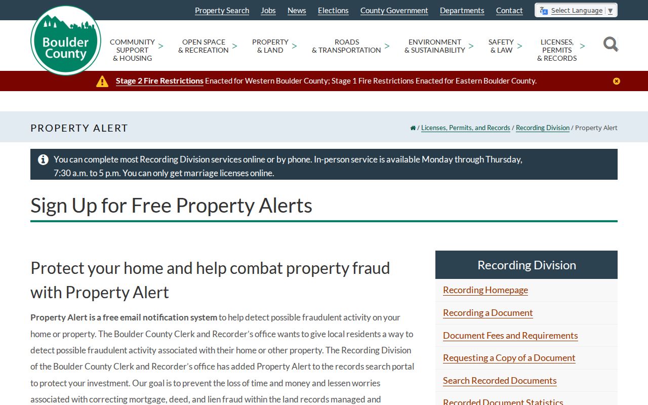
A future notice can help preserve the record trail, but historical proof still comes from the instrument and its independent corroboration.
Boulder County Fire and Missing Records
The original Boulder County courthouse was destroyed by fire in 1932, after an 1882 cornerstone and before a 1934 replacement. A gap in a pre-1932 county series may reflect loss, transfer, an unindexed record, or a different office. It should not be filled with an invented occupant or a broad claim that no record existed.
Use State Archives finding aids, Carnegie, newspapers, cemeteries, deeds, municipal files, and maps to fill different pieces. The current courthouse is a 1933 Glen H. Huntington WPA Moderne and Art Deco building and remains a government seat, but the actual courts use a separate Combined Court route. The records office and court are not one search system.
Boulder County Prior-Resident Timeline
A final house history should make the strength of each fact visible. Use a dated timeline with the source label, not a smooth story that hides gaps. “Listed at” fits a directory. “Recorded party” fits a deed. “Owner field” fits an assessor report. “Burial index” fits a cemetery result. “Hearing row” fits a court docket.
| Evidence label | Safe statement |
|---|---|
| Directory | A named person was listed at the printed address in the stated year |
| Assessor card | The property card contains the stated address or owner clue |
| Deed | The person appears as grantor or grantee in the recorded instrument |
| Obituary | The publication names the event, relatives, or community on its page |
| Cemetery | The index or ledger identifies burial or location context |
House-history use. Previous residents are a historical research subject. Keep current personal details to the minimum needed, respect protected addresses, and do not use an address trail to stalk, harass, or harm anyone.
The current street-level chain belongs on the Boulder County street directory page. The backward trail ends with a sourced timeline, not an unsupported claim about who lived there.